For a start, here is a simple map that will help you get your bearings.
The picture is taken facing the Mandango moutain. North is on the right and South
is on the left. From left to right on the main road you see the trail to Mandango
(camino a Mandango), the market (Mercado) and the bus terminal (Terminal Terrestre),
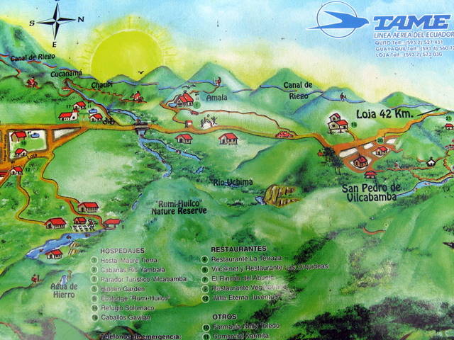
then the Hospital, then, on the map below, the bridge where the Uchima river joins
the Chamba river to become the Vilcabamba river, then the village of San Pedro de Vilcabamba and then finally the main road to Loja which is
42 Km from Vilcabamba. On the Eastern side of town, from left to right, you see
the zoo (there is a monkey on the picture), Yamburara Bajo, then following the river
on the map below, the Rumi Wilco Reserve.
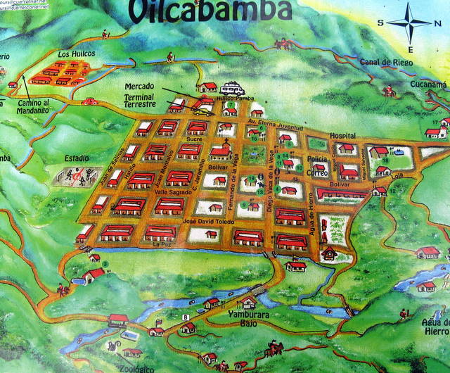
As you would expect, most shops and restaurants are around the central square.
For a detailed map of the village with shops and restaurants click below
Details